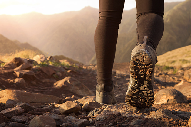
Portugal boasts a remarkable variety of landscapes, which are worth getting to know on foot. With the help of journalist Miguel Judas, who has crossed the country from north to south and wrote a book on the 200 best trekking trails in Portugal, we put together this guide to Portugal, which naturally also includes the Azores and Madeira islands. Come stroll with us!
North:
Rio Minho Ecotrail between Valença and Monção
District: Viana do Castelo
17 Km / Difficulty: Easy
This is a marvellous trail which follows the old railway line along the Minho River, crossing several interesting and historic locations. It has been labelled the third best ecotrail in Europe. The vegetation is sublime and the surroundings provide for a truly unforgettable experience.
Megalithic trail of Castro Laboreiro
District: Viana do Castelo
14 Km / Difficulty: Medium
This trail stands out for being right in the heart of the Peneda-Gerês Natural Park and for following one of the largest necropolises in the Iberian Peninsula, giving one a peek into pre-historic human communities. The trail is completely different from all the others you can find in Portugal, which merits its inclusion in this Guide to Portugal.
Serra Amarela Trail
District: Braga
36 Km / Difficulty: High
Divided into four stages, this trail requires some planning to fit into a weekend. Located in the Gerês, it is a great way to become acquainted with the region and stands out not only for being inside the Natural Park, but especially because of its more wild character.
Center:
Rota da Garganta de Loriga
District: Guarda
9 Km / Difficulty: High
Although short, this is a difficult trail, since it starts at the top of the Serra da Estrela mountain, descending a total of one thousand metres. It passes by traces of glaciers which date back to the last cold period of the area. The trail ends in the Loriga Village, where you can visit the riverside beach. It is unmatched in tranquillity and beauty.
Shale trails of Lousã: The four Villages Route
District: Coimbra
7 Km / Difficulty: Medium
This trail begins at the Lousã Castle, which predates Portugal, having passed from Visigoths to Moors, and was later integrated into the defensive lines of the Mondego. It closes a circular trail which goes through the shale villages of Lousã – Candal, Caterrador, Vaqueirinho and Talasnal – the latter being especially well restored.
The Fossil Route of Penha Garcia
District: Castelo Branco
3 Km / Difficulty: Very easy
This trail begins in the Penha Garcia Castle, in Idanha-a-Nova and descends to the Pônsul River, crossing the Interpretative Centre and the riverside beach. The Pônsul River valley, with its cliffs, is ideal for observing the fossils of trilobites, which lived in these parts over 500 million years ago, when it was a sea bed. The trail ends at the fabulous rotating watermills.
Shale trail of Casal de São Simão – descent to the rocks
District: Leiria
5 Km / Difficulty: Medium/Easy
The typical shale village of São Simão, well restored and crammed on to the cliffside, makes this trail especially worthwhile. The path leads downwards and crosses one of the largest cork tree groves in the region, but also the so-called Valley of Plenty, which was an important local agricultural centre. Along this trail we also cross an amazing wood, including a spot of laurissilva forest, a veritable jurassic park of primitive vegetation which provides a window into how the surrounding area looked before the landscape was changed by human settlement. The path also goes through the Alge stream, ending at the São Simão rocks, its highest point.
South
Fishermen Trail along the Rota Vicentina
Porto Covo to Almograve leg
District: Setúbal and Beja
20 Km / Difficulty: Medium
No guide to Portugal could be without a visit to the Vicentina Route. Our trail begins in Porto Covo and leads through Vila Nova de Milfontes and Zambujeira do Mar, ending in Almograve. It is part of the Fishermen Trail, which connects Porto Covo to Sagres, along the Vicentina Coast. It is especially impressive because of the landscape and the opportunity to enjoy virgin coastlines, unspoiled by human intervention.
Via Algarviana
District: Faro
300 Km / Difficulty: Easy
This is a long walking path which takes around a week to finish and crosses the interior of the Algarve. You’ll go through the Monchique mountain and villages which are completely different from those of the coast, making it an excellent opportunity to become familiar with an Algarve which the general public is still not familiar with. The trail crosses the parishes of Alcoutim, Aljezur, Castro Marim, Tavira, S. Brás de Alportel, Loulé, Silves, Monchique, Lagos, Portimão and Vila do Bispo.
Seven Suspended Valleys Trail
District: Faro
5,5 Km / Difficulty: Easy
This trail runs between the Centeanes and the Marinha beaches, the latter being considered one of the most beautiful in Europe. Its extraordinary beauty makes it one of the most interesting lengths of coast of the Algarve and follows an uninterrupted line of cliffs and suspended valleys, which used to boast waterfalls. It is integrated into a very well-preserved and untouched area.
Azores:
Faial Coast to Coast
The western-most island of the Central Group of the archipelago
36 Km / Difficulty: Medium / High
Being located in the Azores is reason enough for this trail to be included in our Guide. Amidst absolutely stunning landscapes, this hike across the Island allows one to take in its whole geological history. You start off at sea level, in the Boca da Ribeira, where the island began to form following the first eruption, and carry on along trails which used to connect the villages of Horta. Your trip will take you past volcanoes and craters, including the famous Caldeira, the crater of a dormant volcano which has a diameter of two kilometres and a depth of 400 metres. The adventure comes to a close at the Capelinhos, where the last eruption took place, in the 50’s.
Madeira:
Vereda da Ponta de São Lourenço
Antigo District: Funchal / Machico
8 Km / Difficulty: Medium / Easy
This trail begins on the Eastern edge of the Madeira Island and takes you along the volcanic peninsula, with a view over the Desertas and Porto Santo islands. We included it in the Guide to Portugal because it is part of a nature reserve in which the landscape differs completely from the rest of the lush and green island. Here the low growing shrubs contribute to an especially striking scenery, with a large variety of species, some of which are exclusive to Madeira. It is also an excellent place for spotting sea birds and, with a little luck, even monk seals.